Biketinerary
Explore a city using its bikeshare network.
Overview
Biketinerary is mobile app especially for people who love to travel and bike, but maybe aren’t huge fans of planning. With curated routes, auditory narration and information based on location and velocity, travellers can feel confident and free to explore in their travels.
Details
| Class | Crafting UX |
| Toolkit | Paper prototyping, Sketch, Origami Studio |
| Collaborators | Katarina Yee, Kinjal Shah |
| Mentors | Josh Musick & John Leonard, SVA & Frog Design |
Contribution
During the research phase, I conducted a literature review on biking apps and semi-structured interviews with potential users and travelers. During the ideation phase, three of my feature ideas were considered and prototyped, which includes micro interactions like the sliding map on each card in the designs below. I then advocated for collecting user feedback, which helped us narrow our ideas down and also come up with scenarios. I contributed to the information architecture design, and was responsible for creating the inital paper prototypes. I then created the user-flow of the app and an high fidelity interactive prototype using Origami Studio.
Process overview

Background & Research
When we started ideating for this project, one of our ideas was to create an app that helps cyclists avoid road work and other hazards in a crowded city like New York. But in our research, we found that there are plenty of people working in this design space and basically the scope of the problem would be relative larger for a 4 week project. We did however discover an underserved market where we could add value. We identified travellers who use bike shares as a user group to focus on.
Travelers who love to bike might be inclined to use a city’s bikeshare network. As of the end of 2016, there were public bike shares in more than 1,000 cities worldwide. In New York, the Citi Bike system is the largest in the U.S. and continues to expand.

Problem
Our research led us to an interesting prompt, while bikeshares are becoming more and more prevalent all over the world, there’s no support for the users of those networks, who are unfamiliar with the city, its biking infrastructure, and destinations
that can be reached more easily by bike.
How might we help people who enjoy using bike shares, plan and discover points of interests in unfamiliar cities?

Approach
Based on all our research in the domain we came up with scenarios and started wireframing initial ideas.
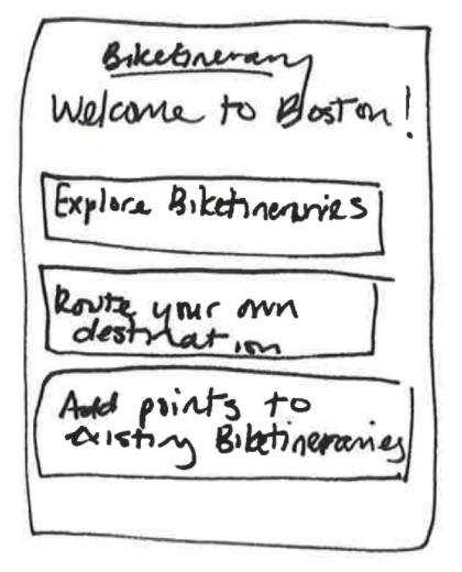
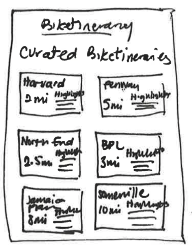
Paper prototypes
Scenarios
The Cautious Tourist
A traveler may land in a new city, see that they have a bikeshare network, but be too overwhelmed and nervous to try to navigate the city by bike. Instead, they’ll choose to stick to walking, limiting the
amount of ground they can cover.
The Intrepid Juggler
A more intrepid traveler might land in a new city, and decide to go for the bikeshare network. But they’re still unfamiliar with the city, relying on a guide book, a map, and other tools to help them navigate
to sites they want to visit.
Solution
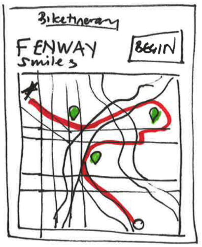
Biketinerary is a collection of curated tours linked to a city’s bikeshare network. Using GPS data, Biketinerary knows where its users are, helping to locate the best sites and biking routes in a city.
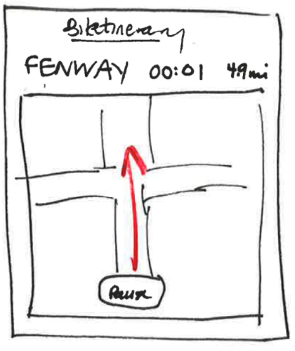
During the ride, the app measures the user’s location and velocity, acting as an audio tour guide for visitors who want to take advantage of the bikeshare network.
Design outcomes
Utilizing the bike share network
Relying on a city’s bikeshare network is an important feature for Biketinerary. Transportation officials carefully plan where to install docks in their cities, based on traffic and the availability
of biking infrastrastructure. Biketinerary takes advantage of this thoughtful planning. Relying on the bikeshare network also makes Biketinerary widely and instantly accessible, even to those of us who are terrible at planning.
Loop
Users can choose the starting point of their Biketineraries and end up wherever the Biketinerary takes them, or they can use our loop feature, bringing them back to their start. This flexibility helps travelers discover
new parts of the city, or return to things that might already be planned.
GPS-based Audio
Biketinerary users have the option to get the full guided tour with interesting facts about the neighborhoods they’re riding through, along with navigation and bikeshare docking help, or just navigation alone.
Bone conduction headphones make it possible for the user to hear her surroundings while using the app. Otherwise, users can stay safe by using only one earbud.
Additional information
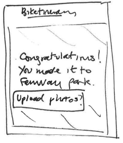
When a user stops at a recommended Biketinerary site, the app will automatically bring up an information card allowing the user to learn more. When she continues on, the card is hidden and the map reappears.
Behind the scenes


